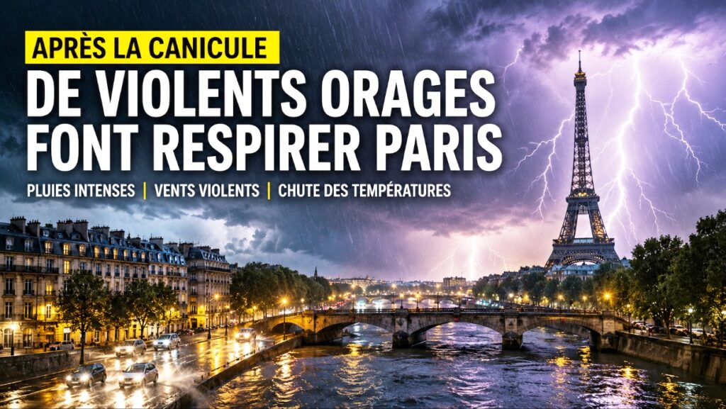
After several days of extreme heat, the weather over Paris changed fundamentally within a few hours. Massive storm fronts swept over the French capital and the entire Île-de-France region on Saturday evening. The long-awaited cool-down brought relief to the people but at the same time caused numerous damages and a busy operation for emergency services.
Already in the evening hours, the sky darkened noticeably. Within a short time, thousands of lightning bolts discharged over the metropolis. Thunder rolled between skyscrapers and historic buildings while torrential rain flooded streets and squares within minutes. Impressive footage of lightning over the Eiffel Tower and the rooftops of the French capital spread rapidly on social networks.
The temperature drop was particularly remarkable. Just before the arrival of the storms, temperatures were well above 30 degrees Celsius. With the cold front, the weather situation changed abruptly. Temperatures fell by more than ten degrees within a short time, providing a much more pleasant night for the first time in days. For many residents, the rain felt like a relief after the tropical nights of the past week.
However, the storms were not limited to heavy precipitation. Meteorologists registered an exceptionally high lightning activity as well as locally very strong storm cells. In several regions north and west of Paris, severe storm gusts occurred. Locally, they reached speeds of up to 145 kilometers per hour. Such wind speeds are sufficient to uproot trees, damage roofs, and significantly disrupt road and rail traffic.
For safety reasons, numerous parks and green areas in the capital remained closed. Authorities recommended limiting outdoor activities to the necessary minimum and not leaving protected buildings during the storms. At the same time, fire departments and technical services had to manage numerous operations. Fallen trees, flooded underpasses, and damaged power lines caused significant disruptions in several départements around Paris.
After the storms crossed the Île-de-France region, the severe weather moved further north towards Hauts-de-France and along the Belgian border. There, heavy rains, hail showers, and stormy gusts were also recorded. Despite the damages, the change in weather brought a clear relief to the previously extreme heat situation.
Meteorologically, such a scenario is hardly surprising. After long heat periods, the atmosphere stores enormous amounts of energy. When cooler Atlantic air meets the strongly heated air masses over France, particularly intense storms with heavy rain, hail, and strong wind gusts often develop. This exact mechanism led to the abrupt end of the extraordinary heatwave.
The events also illustrate how closely extreme heat and severe storms are connected. Climate researchers have observed for years that with rising temperatures, the probability of intense weather events also increases. Long dry spells are increasingly followed by storms that bring enormous amounts of rain within a short time and cause significant local damage. Paris has now vividly experienced this development—and after days of scorching heat, can finally breathe again.
Author: Andreas M. B.